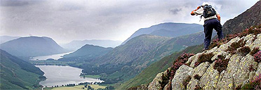
One of the great monuments of modern British publishing is finally being revised in a marathon nine-year project, to prevent Lake District walkers from tumbling into quarries or hunting vainly for paths which are no longer there.
In a labour of love which almost matches the original epic charting of the mountains by Alfred Wainwright, the great man's steps are being followed by a disciple who has already made 3,000 hand-drawn changes to the first of the seven famous volumes.
As dogged and meticulous as Wainwright, who died 14 years ago after a lifelong ban on any alterations, Chris Jesty will be out again on the fells this morning after leaving home at 2am to be above the 1,500ft contour by first light. After two years of tramping, sketching and making often minute corrections to Wainwright's maps and hand-written copperplate text, the 62-year-old Jesty sees the first volume published this month.
"At first glance the hills seem unchanged in hundreds of years, but when you look closely there are dozens of changes on virtually every route in Wainwright's guides," he says, packing his global positioning satellite - a piece of equipment the dour old borough treasurer of Kendal might have envied. Although a notoriously clumsy walker, Wainwright applied his ledger-trained mind to almost every rock, reproducing thousands of fellsides with photographic detail in his pen-and-ink maps, which have sold more than 2m copies.
"The routes of paths have changed, lots of walls have fallen down and when Wainwright was travelling to the fells he used public transport so car parks weren't important to him," said Mr Jesty, a former taxi driver who trained in cartography with Ordnance Survey. One relatively brief and simple scramble up Clough Head, which takes only a page in the first new volume, has 30 pieces of "invisible mending", from minor deviations in the route to vanished walls.
Other alterations are more substantial, including a popular climb up Coniston Old Man which Wainwright describes as zig-zagging up "grassy terraces scented with thyme and tiny alpines". Thanks to a quarry reopening, walkers today would have to levitate across this stretch if they tried to follow the map, which Jesty will correct in the next two years as he works on book four.
For the first volume, The Eastern Fells, he used more than 1m squares of graph paper to plot his GPS data against Wainwright's maps, completing book one while he simultaneously started pencil drawings for book two and fieldwork for book three. He has had one weekday off since June 2003, which he spent appearing on the TV quiz show, Fifteen-to-One.
"It's been a very long story," he said. "I first wrote to Mr Wainwright in 1979 offering to revise his guides. He replied that he didn't want it doing in his lifetime but that I should approach his publishers."
Ten years later, they agreed, but the titles were sold after Wainwright's death in 1991 to Michael Joseph, who decided against any changes. Eighteen months' fieldwork by Mr Jesty was mothballed and gradually became out-of-date itself.
The project, whose most radical change is to show Wainwright's routes in red, was revived after new publishers Frances Lincoln took over the books - luckily while Mr Jesty still had the energy to scramble all over the fells again. Setting a final deadline of 2012 to finish the job, he says: "I feel I am fulfilling my destiny. I first saw a Wainwright guide in 1964 and ever since then it has been an ambition of mine to revise them. It's a job that fits me absolutely exactly."
· A Pictorial Guide to the Lakeland Fells, By A Wainwright, Book One - The Eastern Fells - revised by Chris Jesty is published by Frances Lincoln, price £12.99

